
May 5, 2022 – 1030 AM EDT
It will continue to be a beautiful day up and down the east coast from New England, Upstate NY, and the Great Lakes, through the Mid-Atlantic, Ohio, and Tennessee Valleys to Florida. With high pressure large and in charge, along with the high May sun angle, expect normal to slightly above normal temperatures. We’ll range from the 60s over the Northeastern US, 70s Mid Atlantic, and Ohio Valley, and 80s Southeast and Tennessee Valleys. But west of the Mississippi…
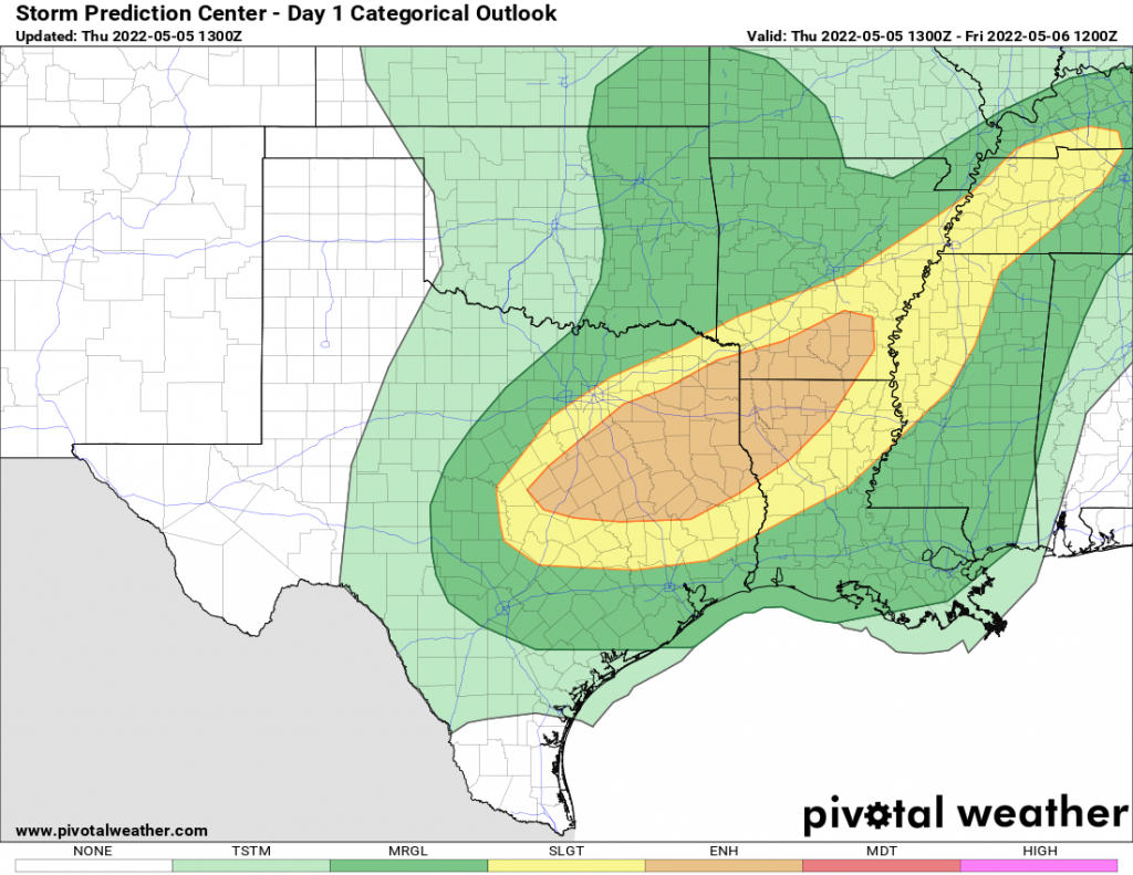
Trouble. A slow-moving storm swirling from Oklahoma will move slowly east. With deep moisture and warmth pumping out of the Gulf of Mexico, it’s the typical recipe for intense thunderstorms with damaging winds, hail, and possible tornadoes. While there was some damage in Oklahoma yesterday from tornadoes, thankfully they were not as widespread nor as intense as feared. Today should hopefully follow the same script. If you are anywhere between Dallas, Memphis, St Louis, and New Orleans… HEADS UP! Stay weather aware this afternoon and tonight, have ways to get warnings if issued and take action if warned.
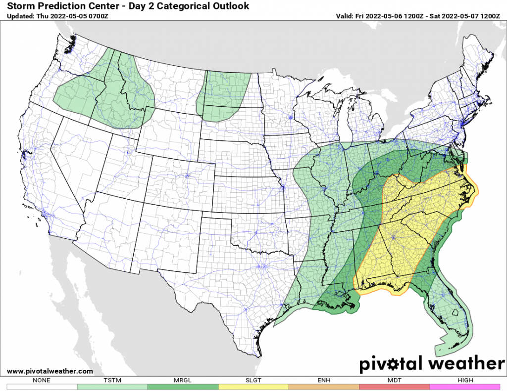
The severe weather threat moves east of the Mississippi Valley on Friday. Storms will fire tomorrow afternoon across Alabama, Georgia, and eastern Tennessee, spreading into the Carolinas and up to central Virginia after dinnertime. Cities under threat and that need to be weather-aware tomorrow include Birmingham, Atlanta, Knoxville, Greenville, Columbia, Charlotte, Raleigh/Durham, Roanoke/Lynchburg, and RVA (Richmond, VA).
The severe weather threat will drop off overnight Friday and this will become a soaking rain from the Ohio Valley to the Mid Atlantic states. It will be a cool rainy day from Ohio to Pennsylvania, New Jersey, Delaware, Maryland, Virginia, and West Virginia. Not all of the states, especially west of the Appalachians, but the threat of rain will be there.
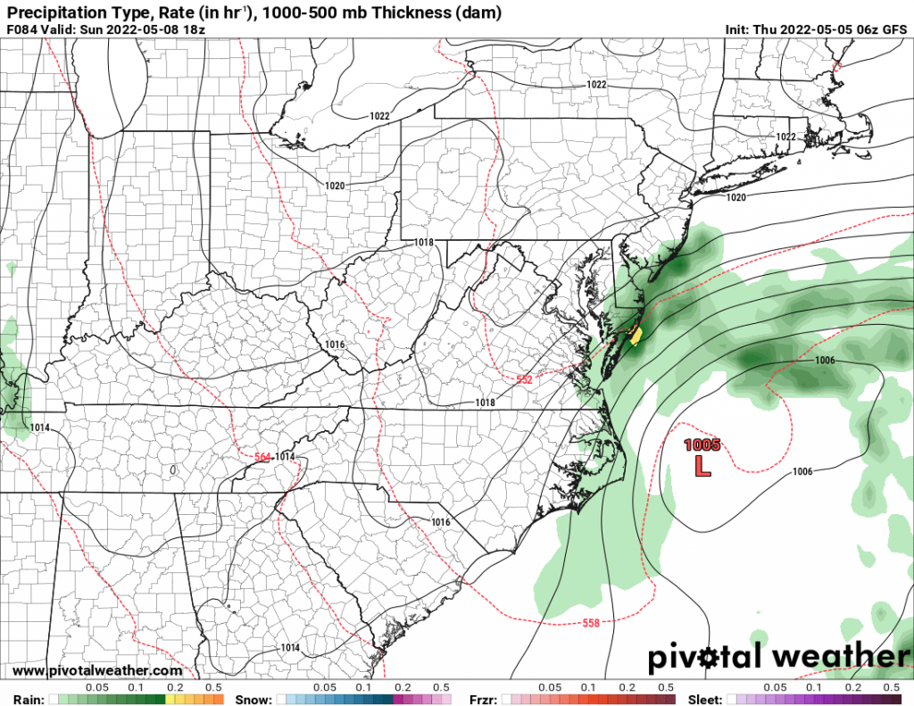
Mother’s Day will be beautiful with sunshine all across the eastern US, east of the Mississippi. The only exception will be close to the coast between NYC and Wilmington, NC as our cut-off storm lingers. The east winds, low clouds, and scattered showers, especially east of I-95 will put a damper on Mother’s Day in these areas. The rest of the interior Northeast, Great Lakes, Ohio Valley, and Southeast will be fine. Big heat brews in Oklahoma and Texas with 100+ temps are very much in the mix. Normally warm in the Desert Southwest, the northern Rockies, and Pacific Northwest will be jacket weather with lower elevation rains and higher elevation snows. Mother’s Day always brings snow… just thankful it’s not in Upstate NY this year!
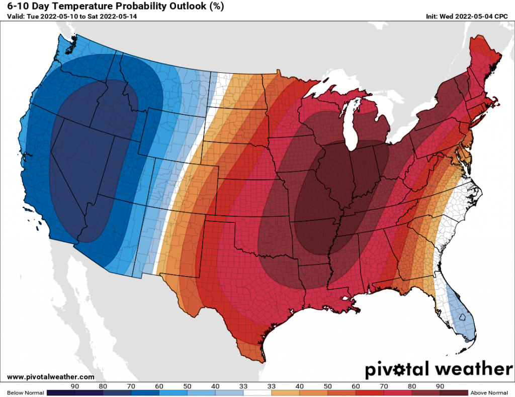
The trends for the middle of the month look very promising east of the Rockies. Sunshine and warmth will dominate most days, things will bloom fully green in areas that have not fully bloomed yet, and we’ll be transitioned into “summer mode” for most of the nation by Mid May. Spending time outside. Ballgames. Ice Cream. Rides in the country. Oh, and BUGS! West of the Continental Divide, it will remain cooler than normal, and unsettled, with periods of lower elevation rains and higher elevation snows. For this part of the nation, anything falling from the sky, especially in May, a climatologically less often time of year to see it, is a HUGE BLESSING on these drought barren landscapes. Even if it only slows the long-term droughts here, anything will help because the hot sunny days and wildfire season will eventually come.
