
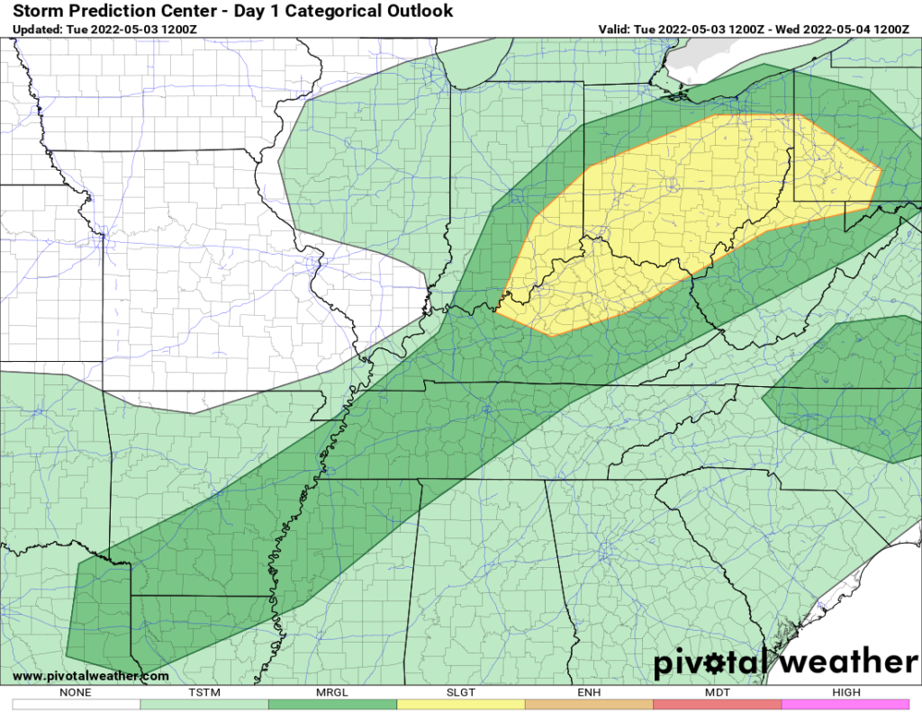
A slight risk for severe weather is present this afternoon and this evening across most of the Ohio Valley. Severe weather threat shifts back to the southern high plains tomorrow afternoon and evening, then to the Mississippi Valley Thursday, then to the Southeast Friday. Mother’s Day Weekend looks nice for most of the country. Next week spring fully arrives EAST of the Mississippi.
This afternoon, be on the lookout along the I-65 corridor from Indianapolis through Louisville to Bowling Green, KY for storms with damaging winds and large hail. A few tornadoes are possible but they will not be a big threat here. Storms move into the Cincinnati area around dinner time, then through the rest of Ohio into Pennsylvania and West Virginia in the evening hours, after dark. The remnants of this storm will rain itself out across Upstate NY, New England, and the rest of the Northeast overnight and into Wednesday.
During the day on Wednesday, our next storm system gets organized over the southern high plains as the slight to enhanced risk of severe weather returns to southern Kansas, Oklahoma, and a good part of Texas. This severe weather threat shifts eastbound and down on Thursday with Missouri, Arkansas, and northern Louisiana. By Friday, the showers and thunderstorms shift across the Southeast to Georgia, the Carolinas, and into southern Virginia. This storm will linger into Saturday, especially near the Atlantic coast, otherwise, a good part of the country gets to dry out.
On Mother’s Day, sunshine and seasonable to warmer than normal temperatures will dominate a good part of the country with no severe weather threats foreseen at this time. Yeah, mom! Sunshine and 60s across the Northeast and Great Lakes, 70s across the Mid Atlantic, Ohio Valley, and Carolinas, 80s, and 90s across the rest of the southeast into the central plains, with 100+ not out of the question in Texas. Cooler and unsettled weather will be in place from Minnesota, through the Dakotas into the northern Rockies and the Pacific NW with lower elevation rain showers and higher elevation mountain snows!
Next week looks warm along and east of the Mississippi with the cooler and unsettled weather remaining across the northern Rockies and Northwest US. For the eastern US, where spring has been slow to arrive and many areas along and north of I-70 are behind schedule with the “greening up”, next week’s forecast for warm and dry weather with lots of sunshine will green things up in a hurry, especially in the Great Lakes and in the Northeast. Something to look forward to!
