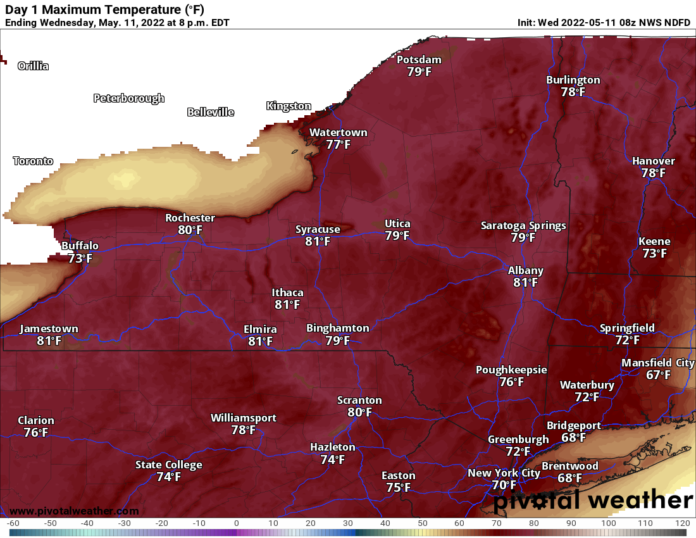
OK Upstate NY you’ve been waiting for this. It is here! Beautiful weather continues for much of the eastern and central US. Severe weather in the high Plains to the northern Mississippi Valley today and especially tomorrow. Some changes next week but not as dramatic as first feared.
If you are anywhere in the Eastern or Central US we are now on at least Day 3 of this cycle and it will continue for at least a few more days. It’s in the 70s and 80s in the afternoons in most places, and as expected, areas not fully green are becoming so quickly. In the Central US, especially west of the Mississippi the heat is up one notch to the point of it’s almost too hot. But not quite. Plenty of temps between 85-95 degrees can be found throughout the Central US with Texas the biggest offender and the highest chance of seeing temps in excess of 95. But it’s not super humid (yet) and it’s not super hot (100s… yet). So while it could be a little more comfortable, it could very well be worse too.

So since it’s cool in the northern Rockies/Pacific NW and hot in the Central US… is that where the battle zone is? Yes it is! Severe weather threats this afternoon and tonight are focused on the high Plains but concentrated in the northern Mississippi Valley. Minnesota especially is target number one today and especially tomorrow. Tomorrow afternoon and evening is looking like the biggest severe weather threat of the week with widespread damaging winds and hail, with some tornadoes, from the eastern Dakotas to Nebraska, Iowa, Minnesota and even into Wisconsin. More on this threat in tomorrow’s report.
The big storm this weekend will still be there, and it will still get cooler behind it, especially across the western Great Lakes. But the cold air blast behind it is looking a lot more muted. Instead of temperatures going down to “WTH” levels for May, it’s more of a correction to closer to normal. Some areas will fall below, some will be closer, but the threat of widespread frosts and late season snowflakes across the northern US looks a lot less at the moment.
Looking farther ahead, the weather patterns are going to settle in. Summer takes full control of the southern US, particularly Texas, the Desert Southwest, lower Mississippi Valley and the Southeastern US. More of a transition zone across the northern tier of states… but no dramatic swings to super warm or super cold are foreseen at the moment. So now that we are getting into mid-May and the weather is acting more like it… get out and enjoy the sun!

